

- The 10,007-foot-tall pass connects Crested Butte and Highway 133.
- Intense changing colors of aspen stands color the hills in the fall.
- A popular snowmobiling route in the winter.
- The 30 mile-long drive (one-way), takes a little under 2 hours.
Overview
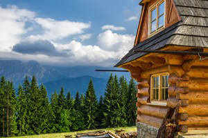
An old railway grade, the two-lane gravel road that goes up and over Kebler Pass is a popular route for anyone travelling between Crested Butte and Carbondale, Paonia, Delta or Montrose. Beautiful aspen stands, the surrounding West Elk Mountains and the Ruby Range create a scenic drive with endless photography options.
Kebler Pass is an incredible drive during fall when the leaves change to brilliant oranges and reds.
Kebler Pass closes during the winter, usually between early to mid-October and mid- to late June. In the winter months, Kebler Pass is a popular snowmobiling route.
Driving Directions
From Crested Butte, take CO-12 (Whiterock Avenue) west out of town. CO-12 climbs up and over Kebler Pass before intersecting with Highway 133. Turn right to go south toward Somerset, Paonia and Hotchkiss or north toward Carbondale.
Time/Distance
Kebler Pass, between Crested Butte and the intersection with Highway 133, is just over 30 miles long, and usually takes just under two hours.